I walked this stage of the Icknield Way Path expedition at the end of May 2014.
I arrived at Royston and picked up the Icknield Way east towards Great Chesterford, a hike of about twelve miles.
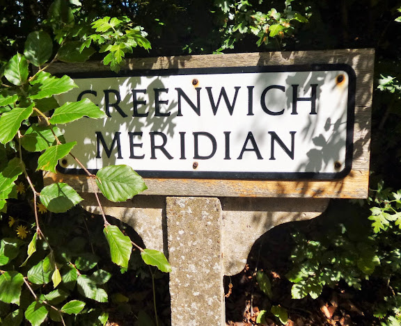
Leaving Royston took me over the Greenwich Meridian, a good place to check that one’s compass is actually working (mine was).
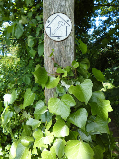
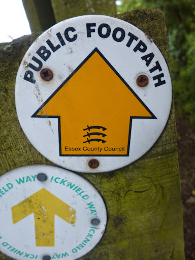
Half an hour later I was on the trail proper.
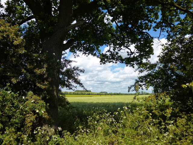
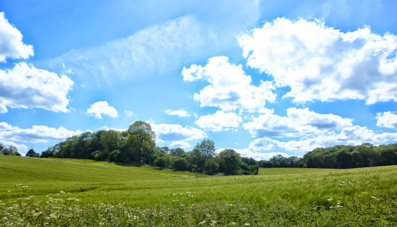
The countryside looked and felt exuberant in the early summer light.
After a couple of hours I discovered I had crossed the county border and was now in Essex. This came as something of a (pleasant) surprise as I was expecting to be in Hertfordshire.
I haven’t hiked in Essex at all but am keen to do so, it’s a large county just asking for exploration.
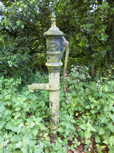
In the village of Chrishall I came across an old water pump.
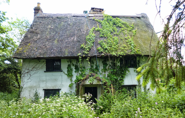
and a rather spooky abandoned cottage. Looks like something out of the Blair Witch Project.
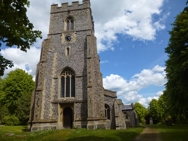
I ate my lunch beside the fine church at Elmdon.
The countryside was gently rolling and very inviting in the afternoon sun. I sat down for a break and watched fighter jets from the nearby Duxford air show as they looped-the-loop and pirouetted in the summer sky.
I did consider a short siesta but time was against me as I wanted to catch the hourly train at Great Chesterford.
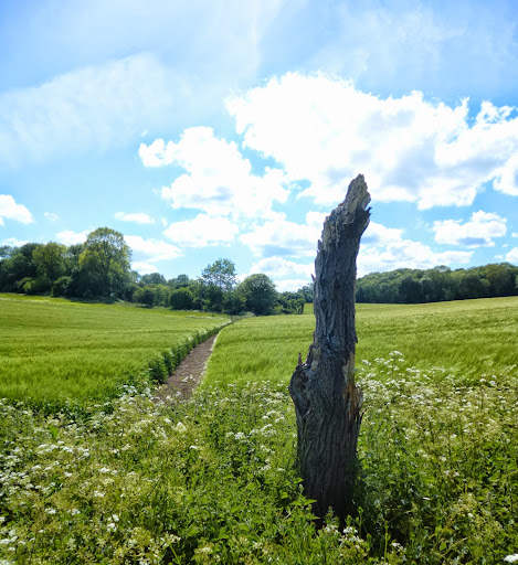
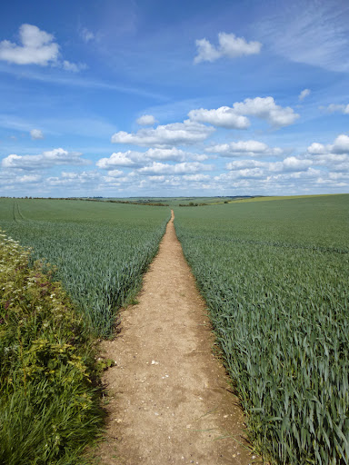
The last half hour or so of the hike took me across fields…
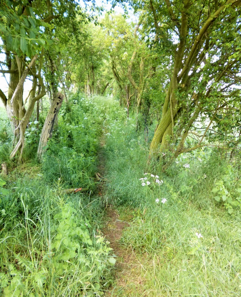
…and through green corridors.
And then, suddenly, I was on a footbridge above a busy dual-carriage way and jogging the final 100 metres to Great Chesterford station where I could see my train pulling-in. Just on time!
Essex is a fine county indeed, one I’m looking forward to seeing more of. As for the Icknield Way, the next stage is a long one, 18 miles or so, perhaps this calls for a cheeky wild camp? We’ll see.
wonderful post, great photos too .. are you planning on walking the whole of the Icknield Way? [Thought of you the other day when I bought Phoebe Smith’s ‘Extreme Sleeps: Adventures of a Wild Camper’ -]
Yes, the plan is to walk the whole of the Way, much of it is within easy(ish) reach of my home : )
Good stuff that sir.
As I tweeted, I am going to have a bash at a lot of this later this year, once the knee is back to full fitness. Plus the North Norfolk Coastal Path again in hopefully July, and Dartmoor in August.
But the Icknield Way to the Peddars Way in nice weather is very inviting, and not too hilly.
18 miles is a long day, although in summer you could walk from 6.00am to 8.00pm and make it quite leisurely I reckon. Having said that, a wild camp is always a nice, with a small flask of Malt, and maybe a wee pub stop beforehand for a beer.
Yep, I am gonna do it!! 🙂
Yes, the Peddars Way looks good, and then I’d have to finish it all off by doing the Ridgeway…hope your knee gets sorted soon.
To be honest, the Peddars Way is better as a bike ride in the main.
For a real treat, the North Norfolk Coastal path is a GEM!
ok, that’s interesting to hear you talking about the Peddars Way as a bike ride, I’ve been getting back into cycling, a little tour might be fun : )
It is a great bike ride (you have to veer off slightly in places. We finished in Thetford to get the train. Did it with my daughter last year
(/a>
Now, here’s a trip thought.
Icknield Way (110 miles) to Angles Way (76.7 miles) to Weavers Way (61 miles ) to North Norfolk Coastal path East to West (approx 46 miles) to Peddars Way (approx 46 miles)
Maybe not all in one go.
Hmm that last link did not go right.
I seem to have created the whole sentence as a link to my
Peddars Way ride
And here is my take on North Norfolk Coastal Path
Part 1
Part 2
Music’s not half bad too 🙂
Nice, I’ll check the links out : )
Yes . Meandering through the fields and woods on a glorious English summers day . nothing like it Wonde why the cottage is abandonned. lack of mains services ??
Indeed Bob, can’t really be beaten!
If you wish to shorten the next day, then you could walk to Linton and catch the twice-hourly no. 13 bus from Cambridge to Haverhill, which calls at Linton. However Great Chesterford to Linton is only five miles, so perhaps one to do when you’ve only got half a day?
Or you could walk 7.5 miles to just north of Linton, and then walk the Roman Road westwards back to Cambridge – another 9.5 miles to Cambridge station, or east to Haverhill and get the bus (7.5 miles).
One thing to note about wild camping in the Newmarket / Dullingham area – there are lots of stables, and the path often runs between paddocks guarded by fences. It may be difficult to find somewhere suitable. Looking at Google Earth before you set off might help.
There are plenty of pleasant walks in that area. If you get time, call in at Balsham church to see the spectacularly large font cover.
Thanks for the tips David, I’ll take a good look at Google Earth and see what’s on offer and I’ll make a note of Balsham church.
This hike reminded me of our recent visit to family in Sandy, Bedfordshire, and the network of paths criss-crossing the area. Needless-to-say I spent many hours just wandering through the magnificent countryside.
There are some great images and narration here Martin and am looking forward to your report on the Icknield way.
Glad you enjoyed the post, I’ll continue posting about the Icknield Way : )
When we walked the Ridgeway I would myself wondering if the Icknield Way would be as well maintained, because it coincides for long distances. It looks like it is. I too haven’t touched on Essex yet, but will be next week for the first time. Albeit as part of the London Outer Orbital Path. I fear those bits might not be quiiiite as scenic as yours.
Love that photo ‘Towards Great Chesterford’ – lovely colours.
I plan to start on the Ridgeway after finishing this hike, I love the idea of walking from east to west England.
Once again, Martin, lovely photographs of very beautiful countryside. I envy you these walks, but my days for walking long distances has sadly passed. But it’s good to see it all through your eyes and look forward to the next instalment.
Glad you enjoyed the post mum : )
Great photos
Cheers, glad you enjoyed them
Thank Martin,
You were right it was in my spam folder! I’m glad I checked, really nice pictures agree with your mum and all the other comments, it’s all so inviting!!!
Thank you
Lorna
Hi Lorna, glad you found the email and enjoyed the post and pics : )
Great photos. I lived in Cambridge for a while and used to love walking and cycling around here. Made me feel all nostalgic.
Cambridgeshire has some fine walking country, glad you enjoyed the post!
Wow – that cottage! Love the green corridor too.
Hi. Tried looking for the cottage today, no luck 🙁 I don’t suppose you could give me an exact location? Would be great if you can 🙂 I have a rather unusual hobby of taking photos 😉 Thank you. Kim.
Hi Kim, my memory of the walk is a little hazy now. I think I saw the cottage coming into the village from the north. Take a look at Bing Maps http://binged.it/1LBYokW with the OS layer turned on and follow the route of the Icknield Way and you should find it. Good luck!